Amazing Places - Mount Arrowsmith Biosphere Region
The Amazing Places Project connects people with nature in Canada's UNESCO biosphere reserves and educates residents and visitors about the ecological significance of well-loved, publicly accessible outdoor spaces.
The Mount Arrowsmith Biosphere Region and Parksville Qualicum Beach Tourism presents... Amazing Places! The Mount Arrowsmith Biosphere Region Amazing Places is one of only three such projects in Canada with the others located in Ontario and New Brunswick.
The goal of Amazing Places is to identify and promote significant natural sites for residents and visitors to explore in order to encourage better knowledge of ecological features and inspire a commitment to conservation. All Mount Arrowsmith Biosphere Region Amazing Places were nominated by the public.
Amazing Places GeoTour
Experience the magic of the Mount Arrowsmith Biosphere Region’s 10 Amazing Places with the Official Amazing Places GeoTour!
The Amazing Places GeoTour consists of 6 traditional geocaches and 2 multi-caches. To complete the GeoTour, use the coordinates in the Field Guide or on the geocaching app to find the geocaches.
When completed with 8 coin rubbings and 10 GeoClue answers, bring your completed cache code collection page to one of the locations listed in the Field Guide to get your unique Mount Arrowsmith Biosphere Region Amazing Places GeoCoin!
Amazing Places Adventure Labs
Adventure Lab is a new app and platform from the team at Geocaching HQ that allows you to create, play and share unique outdoor scavenger hunts, experiences, and games. There are currently over 20,000 public Adventures available worldwide. The Adventure Lab® app guides players through the process of finding clues, solving puzzles, and completing Adventures one Location at a time. If you’re already a Geocaching member, these stages count as caches towards your Geocaching account’s statistics and total finds.
Mount Arrowsmith Biosphere Region has created three Amazing Places Adventure Labs: Ecosystems, Watersheds, Humans and Nature. Visit the locations to see why these places are worth protecting, learn more about watersheds, and how getting connected with nature helps us and the environment.
Top Bridge
Top Bridge is the junction of three parks and a conservation area along the Englishman River, tied together by Top Bridge Crossing suspension bridge. The water that flows through this canyon has been a source of life for humans, wildlife, and plant species for time immemorial. This Amazing Place continues to bring people together through leisure and stewardship. If driving, Top Bridge is at the end of Chattell Road, off Kaye Road, off Hwy 19A (by the truck scales). Alternatively, drive to the end of Allsbrook Road (off Bellevue Road, off Hwy 4A).
Heritage Forest
Alive with fascinating fungi, the Heritage Forest is a powerful story of community-led conservation and stewardship in the heart of the Town of Qualicum Beach. Besides its natural beauty, the Forest protects and nourishes the salmon-bearing stream known as Beach Creek and is home to Barred owls and Pileated woodpeckers who inhabit the wildlife trees among the old-growth. A breathtaking haven with much to teach us. Only five minutes from downtown, the Qualicum Beach Heritage Forest is protected by a Covenant to ensure that it remains as an ecological reserve, available to all for the purpose of observing and appreciating nature. Find out more about the Heritage Forest here.
MacMillan Provincial Park (Cathedral Grove)
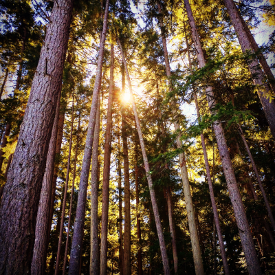
In a cathedral-like grove of old-growth Douglas firs, MacMillan Provincial Park is known for its majestic grandeur. A network of trails guides you through a gathering of ancient trees - some over 800 years old. Less obvious to the eye are the small wonders that live within the overarching canopy: lichens, insects, and birds. Something new to take in on your next visit. Find out more about MacMillan Provincial Park right here on the BC Parks website. This Amazing Place is located on central Vancouver Island, 25 km west of Qualicum Beach on Hwy #4, which runs right through the park. From Hwy #19 and Hwy #19a take the exit to head west on Hwy #4 toward Port Alberni.
Parksville Community Park
A beloved gathering place for residents and visitors alike, the Parksville Community Park is located along a picturesque and ecologically significant stretch of the Salish Sea. This park was designed to connect people with nature and to call attention to incredible natural phenomena such as the Brant geese who pause here every spring to feed on herring roe on their journey from Mexico to Alaska. This Amazing Place is the jewel of Parksville. Read more about the Parksville Community Park here and find out about all existing amenities here.
Milner Gardens & Woodland
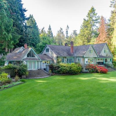
Experience the magic of 28 hectares (70 acres) of unspoiled natural beauty perched on the edge of an oceanside bluff overlooking the Salish Sea. Stroll the winding pathways and magical surroundings of an ancient coastal Douglas fir forest. Find peace and tranquility as you meander 4 hectares (10 acres) of woodland gardens lined with rhododendron, cyclamen, and trilliums. Welcome to Milner Gardens & Woodland, an Amazing Place indeed. Find out more here. Experience Milner's Christmas Magic in December. It's a true festival of lights and entry is by donation. More info here.
Little Qualicum Falls Provincial Park
Embraced by a lush forest and steep mountain peaks, the breathtaking waterfalls that cascade through a rocky gorge make Little Qualicum Falls Provincial Park a natural gem of the region. The Little Qualicum River watershed starts its journey at Labour Day Lake on Mount Arrowsmith, passing through Cameron Lake before entering the Salish Sea. Many different species of fish depend on the Little Qualicum River for habitat, including steelhead, coastal cutthroat trout, rainbow and brown trout, and chinook salmon. The Little Qualicum Falls campground and day-use area is located 19 km west of Parksville on central Vancouver Island, on Highway 4. The Cameron Lake day-use area is located 23 km west of Parksville on Highway 4. Find out more.
“ ...the breathtaking waterfalls that cascade through a rocky gorge make Little Qualicum Falls Provincial Park a natural gem of the region. ”
Englishman River Falls Provincial Park
One of five BC Parks found within the Mount Arrowsmith Biosphere Region, Englishman River Falls Provincial Park features two magnificent waterfalls and is set within a lush old-growth and second-growth forest of Douglas fir, cedar, hemlock, and maple. Breathtaking views, hiking trails, a deep crystal-clear pool for summer swimming, and an ideal place to view salmon spawning in the fall are several reasons to celebrate this Amazing Place. Not to forget is the ecological significance of the Englishman River, an invaluable source of life for plant and fish habitat and for the people who drink daily from its waters. Englishman River Falls Provincial Park is located 13 km southwest of Parksville on central Vancouver Island. Take Errington Road off Highway 4, toward Port Alberni. Directional signs are posted on main highways. For more info, click here.
Cameron Lake
Surrounded by Mount Arrowsmith to the south and Mount Wesley to the north, Cameron Lake's deep cold water is a favourite destination for locals and visitors to swim, fish, and sailboard. The lake is fed by the Little Qualicum River, which flows from its highest point at Labour Day Lake on Mount Arrowsmith. Part of the Little Qualicum Falls Provincial Park, Cameron Lake and its connected watershed are extremely important for many different species of fish and other creatures like the otter. There are two places to view and enjoy Cameron Lake within the Mount Arrowsmith Biosphere Region: The Day Use area is the more popular spot for visiting Cameron Lake and will be the first area you drive by if coming from the east coast if the island (e.g. Parksville or Qualicum Beach). There's a lovely beach, great views of the mountains, and plenty of activity in the summer months. The interpretive sign will be located here. You can even consider taking a hike from this spot along the Arrowsmith CPR Regional Trail to get incredible views of the lake from high above. The Beaufort area is a second, quieter place from which to enjoy Cameron Lake. It's just a minute or two further down the road, driving west along Highway 4. Parking is limited but if you're a small group or looking for more of a meditative experience with nature, come here.
Notch Hill
The southernmost Amazing Place designated in the region, Notch Hill provides incredible views of the land and surrounding waters and is home to the impressive yet endangered Garry oak ecosystem. This ecosystem is a rich mosaic of plant, animal and insect species. Garry oaks (Quercus garryana) themselves are the only native oak trees in western Canada (west of Manitoba). To experience the beauty and unique attributes of this Amazing Place, visit Notch Hill."Notch Hill climbs a total of 240 metres or 787 feet: the round trip is 3 km (about 1.25 miles). It takes about 30 minutes to climb to the top, which included time for rests and dawdling along taking photos. . . The trip up the hill is via a pretty well-maintained trail that snakes through Arbutus meadows and a Garry Oak eco system. . . Notch Hill is located off Powder Point Road, which turns into Fairwinds Drive, in the com A munity of Nanoose. There is a well-marked parking lot on the right-hand side of the road leading to Fairwinds" (vancouverislandbeyondvictoria.com).
Rathtrevor Beach Provincial Park
With almost a kilometre of sandy beach at low tide, a panoramic view of the Coast Mountains across the Salish Sea, and the spectacular Brant migration occurring each spring, it is no wonder that Rathtrevor Beach attracts an average of more than 500,000 visitors annually. Waves, wind, and other natural processes shift the sand along the shoreline, forming coastal dunes, an endangered ecosystem where native plants rely on specialized adaptations to survive. While you admire the view, don't forget to look down at your feet, and consider the understated, resilient beauty of life on the shores of Rathtrevor. Rathtrevor Beach Provincial Park is located 3 km south of Parksville on Hwy 19a, on central Vancouver Island. Take exit #51 from the Inland Island Highway (Hwy #19) and follow signs to the park. For more info from the BC Parks website, click here.
Safety First
AdventureSmart
No matter what outdoor activity you are planning, be prepared. Follow the three Ts—trip planning, training, and taking the essentials. AdventureSmart is a great resource to help you get informed before heading outdoors.
Learn MoreAbout the Author
Parksville Qualicum Beach
There’s nowhere else quite like VIU's Milner Gardens & Woodland – a tranquil botanical retreat where a historic estate...
