
Natural Wonders of Oceanside
"Oceanside" is a local term for the vast area between Nanoose Bay in the south to Deep Bay in the north. It also includes the area leading up to Cathedral Grove to the west.
There are 12 small communities within the Oceanside area, with the most well-known being Parksville, Coombs and Qualicum Beach.
The area is defined by its beauty. There are breathtaking waterfalls that cascade into crystal clear rivers; rock-faced cliffs that balance over picturesque swimming holes; colourful gardens and trails surrounded by old-growth trees; stunning views of vast sandy beaches and beautiful bays; delicate landscapes of ancient fossils and crystal formation; and sensitive ecosystems teeming with life.
I present to you the natural wonders of Oceanside!
Top Ten Natural Wonders of Oceanside
Notch Hill
This well-loved trail in Nanoose Bay leads to incredible views of the surrounding land and waters. It's also home to an impressive Gary Oak ecosystem, as well as an Arbutus grove.
Due to it being quite a short trail, the climb of 240 meters (787 feet) to the top is quite steep. But you should be able to arrive at the top in under 30 minutes. The total hike there and back is approximately 3 km.
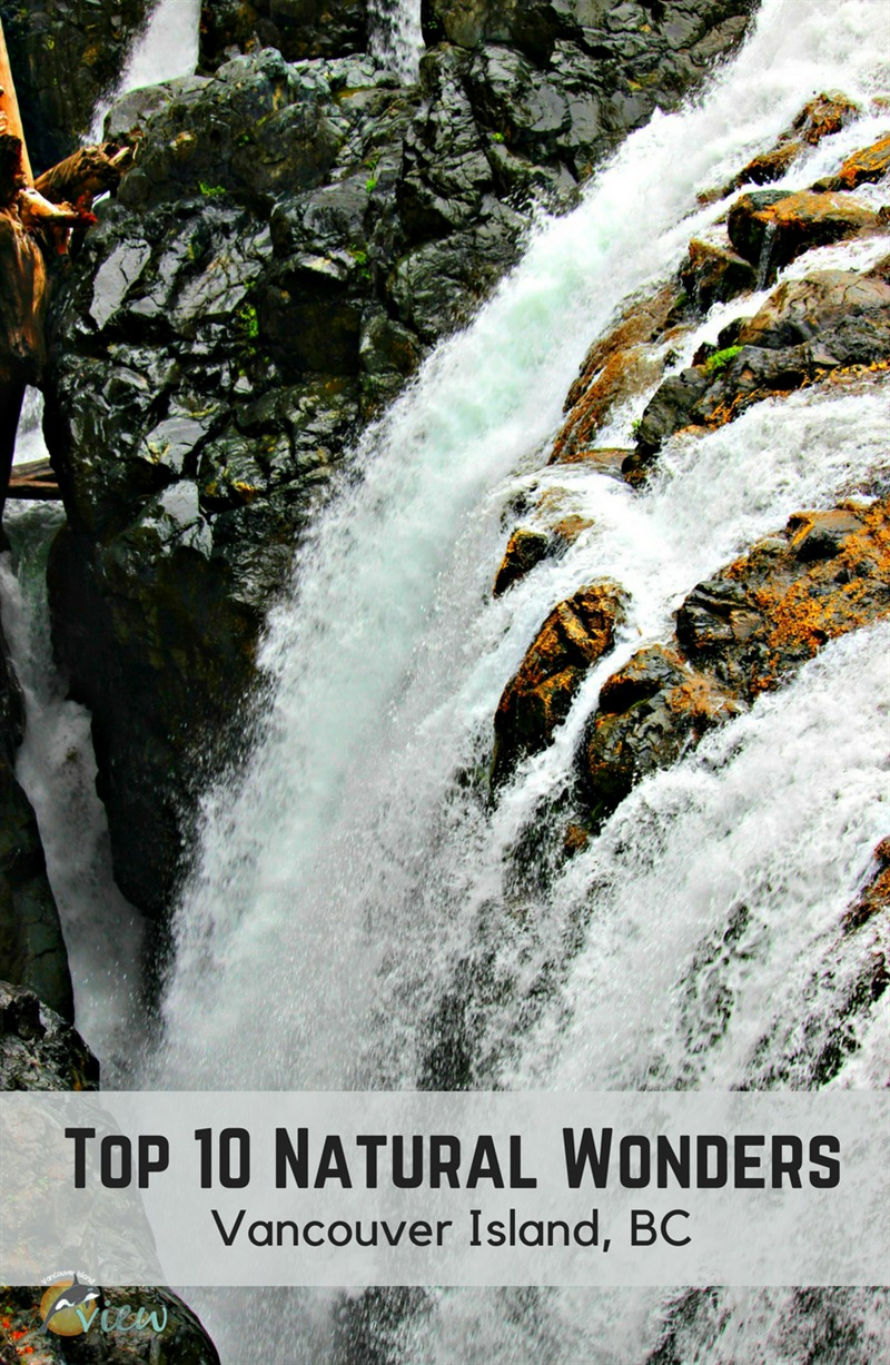

There is a great network of biking and walking trails, cool fresh water pools perfect for fishing and/or swimming, and magnificent rock-faced cliffs that teeter over the beautiful Englishman River.
Getting There
Top Bridge has several access points. For easy access to the suspension bridge, head to Chattell Road. Just past the truck scales on Highway 19A, you will come to a four-way stop. Continue through this four-way stop and then turn right onto Chattell Road. You will find the large parking area at the very end.
If you are up for a bit more of a walk there are four other entry points. You can catch the trail at Rathtrevor Beach Provincial Park; anywhere along Resort Way; at Industrial Way and Tuan Rd (one block inland from Hwy 19A); or, from the end of Allsbrook Rd (off Bellevue Rd, off Hwy 4A).
History
Rathtrevor was named after the Irish family who homesteaded the land surrounding the beach. William Rath, a gold prospector from Ireland, his wife, Elizabeth, and baby daughter arrived in the area in 1895. They cleared the land and built a log cabin and barn. In 1903 William died, leaving his wife and their five children the farm. Elizabeth proved to be an industrious person and eventually operated the farmland as a campground. Apparently, the suffix "trevor" was added to give the campground a more lyrical name.
The campground became Rathtrevor Beach Provincial Park in 1967.
Getting There
Rathtrevor Beach fronts many of Parksville's resorts along Resort Drive, as well as the Provincial Park.
The most convenient public access to this desirable beach is through the provincial park, which is located at the east end of Parksville off of Highway 19A. Ample parking is available at the provincial park.
Getting There
Englishman River Falls is located in the same area as Englishman River Provincial Park. From Parksville, take Highway 4A (Alberni Hwy) towards Errington. Turn left onto Errington Road off Highway 4A (watch for directional signs posted on the highway). Follow Errington Road right to the end.
Getting There
Hamilton Marsh is located approximately 4 km north of Coombs on South Hilliers Road, just off the Alberni Highway (Highway 4) on the way to Port Alberni. There are two entrances to the Marsh on South Hilliers Road. The first one is just after you turn off of the Alberni Highway. The second is a bit further down South Hilliers Road. Watch for large rocks on your left-hand side indicating the parking area(s). The second entrance is the easiest access to the Marsh and has the most available parking space.
Getting There
Little Qualicum Falls Provincial Park (campground and day-use area) is located 19 km west of Parksville on Hwy 4 (Alberni Hwy). Watch for signage along the highway to lead you.
The estate was acquired by Vancouver Island University in 1996, with a goal to maintain the garden in perpetuity for education and the community's benefit.
For a more in-depth history, head to the website of Milner Gardens.
Getting There
Milner Gardens is located in Qualicum Beach off of highway 19A (West Island Hwy). The official address is 2179 West Island Highway, Qualicum Beach. Watch for signs along the way. There is ample parking near the entrance.
Qualicum Beach Heritage Forest
This little gem of a forest sits in the heart of Qualicum Beach. It's a quiet unassuming place to take a leisurely stroll. You will be amongst ancient Douglas Fir trees, and will probably hear and/or see a variety of birds. On your walk, you will also view Western Red Cedar, Hemlock, Grand Fir and Sitka Spruce. Use the provided benches to sit and enjoy your surroundings.

History
In 1995 the Brown Family Trust expressed an interest in selling the Brown Mansion (now called Crown Mansion) along with the immediate 5 acres and surrounding 50 acres of forested land. The Brown Property Preservation Society was then formed. Their goal was to raise funds through public donations for the purchase of the land with the intent to protect it from development. The area was last logged in the 1870's, which is why you will find some ancient trees over 700 years old! It might be interesting to note that very little of the coastal Douglas-Fir ecosystem is protected, making this forest quite significant.
The Trails
The bark mulched trails that meander through the 50-acre property are wide, flat and easy to walk on. There is approximately 2 km of trails available for public use.
Getting There
There are a few access points and parking areas for the Heritage Forest. The main access is next to the Crown Mansion on Crescent Road (292 Crescent Road East, Qualicum Beach). There is also parking available on Chester Road, Hemsworth Road, and St. Andrews Road.
The south side of the highway is where you will find the largest of these Douglas Firs. One of these beauties measures more than 9 metres in circumference!
A Bit of History
As early as the 1920's Cathedral Grove was a well-known tourist stop. And for many years the public encouraged the Provincial Government to acquire the land. In fact, in 1929, an organization called "The Associated Boards of Trade of Vancouver Island", petitioned the government to preserve the forest forever for public benefit.
It wasn't until 1944, when H.R. MacMillan, a well-known forester, donated the 136 hectares of land solely for the perpetual enjoyment of the public. He did so in recognition of the unique stand of trees. Three years later, the area was established as a Class A Provincial Park.
Getting There
MacMillan Park (Cathedral Grove) is located on Hwy 4, on your way to Port Alberni. When you see a mass congestion of cars parked on either side of the road, you know you have arrived!
From Hwy 19 and/or Hwy 19A, take the Highway 4 exit and head west toward Port Alberni.
Horne Lake Caves
Caving offers an exploration of an amazing underground world not many people get to experience. If viewing the wonders of stalagmites, stalactites, crystal formations, underground waterfalls, and ancient fossils intrigue you, then caving might just be your thing.
And I can't think of a better place to start than Horne Lake Caves Provincial Park.

A Bit of History
The park was established in 1971 at the request of public caving groups on Vancouver Island. They were concerned about the potential damage of the caves and the fragile crystal formations contained within.
The Caves
Although you can explore a small portion of the caves at Horne Lake on your own, I highly recommend booking one of the five guided tour opportunities the park offers. You not only get to see more, but your guide will educate you along the way! For an in-depth look at the tours available, check out our post exclusively on Horne Lake Caves.
Getting There
The park is accessed via the Horne Lake exit off of Hwy 19 or Hwy 19A. Follow the signs for 12 km to find the caves.So, have I convinced you yet why you should explore the 10 natural wonders of Oceanside?
This is a guest article by local Vancouver Island blog, VancouverIslandView.com.
Explore More

Your Guide to Renting an E‑Bike or E‑Scooter in Parksville

A Guide to Camping in Parksville Qualicum Beach
Reconnect with nature when you go camping in Parksville Qualicum Beach.

26 Suggestions for your Girls Getaway
Planning a girls getaway to Parksville Qualicum Beach? Here are 26 places to visit for your best trip ever.

A Date for Every Desire
Plan the perfect date in Parksville Qualicum Beach for every occasion.